Armenia hiking: 7 days on the trails
Who this itinerary is for
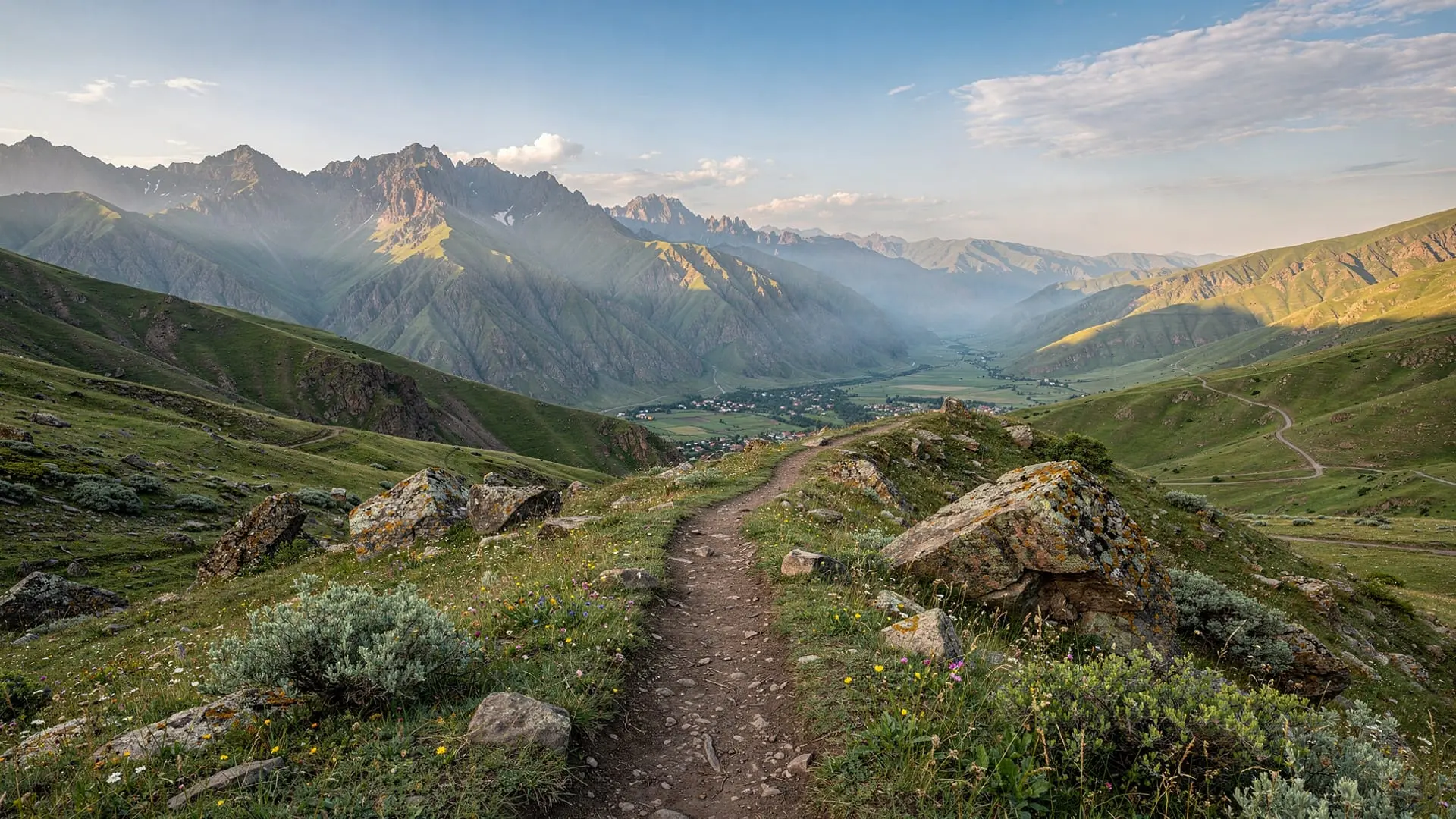
Armenia is more hikeable than most European travellers realise. The country has one serious long-distance trail (the Janapar), a 4,090-metre peak accessible without technical climbing (Aragats southern summit), a national park with well-marked trails (Dilijan), and one of the most dramatic hikes in the South Caucasus (Khustup above Kapan in Syunik). Seven days allows you to sample all four hiking environments — volcanic plateau, dense forest, alpine gorge, and subalpine ridge.
This itinerary is aimed at fit hikers comfortable with long days on uneven terrain. Aragats southern summit involves 900m of ascent on loose scree; Khustup involves similar terrain with a longer approach. Dilijan national park trails are easier — well-marked, forested, with modest elevation gain.
Who this is not for: casual walkers who want a stroll with a view, travellers hoping to do everything from Yerevan on day trips (Khustup requires an overnight in Kapan or Goris), and anyone with high-altitude health concerns (Aragats summit is 3,879m — mild altitude effects are possible).
No car is required for the guided tour days (Aragats, Dilijan NP). A car or local taxi is needed for Khustup.
Quick overview
| Day | Hike | Terrain | Difficulty | Overnight |
|---|---|---|---|---|
| Day 1 | Yerevan arrival | — | — | Yerevan |
| Day 2 | Aragats southern summit | Volcanic scree, 3,879m | Challenging | Yerevan |
| Day 3 | Amberd + Kasakh gorge | Forest + gorge rim | Moderate | Yerevan |
| Day 4 | Dilijan NP: Parz Lake to Goshavank | Forest trail | Easy-Moderate | Dilijan |
| Day 5 | Dilijan NP: Haghartsin forest loop | Forest + ridge | Moderate | Dilijan |
| Day 6 | Travel to Kapan + Khustup approach | — | — | Kapan/Goris |
| Day 7 | Mount Khustup sunrise | Alpine ridge, 3,206m | Challenging | Depart |
Day 1: Yerevan arrival and gear check
Arrive at Zvartnots Airport. Yerevan centre is 12 km from the airport (20 min by GG Taxi, ~3,500-4,000 AMD). Check into your hotel and spend the afternoon preparing for the Aragats hike tomorrow.
Essential gear check:
- Sturdy hiking boots (waterproof, ankle support — essential for Aragats scree)
- Layers for Aragats summit (temperature can drop to 5°C even in July at 3,879m)
- Trekking poles (strongly recommended for the descent on loose scree)
- At least 3 litres of water capacity (no water sources above Lake Kari)
- High SPF sun protection (alpine UV at 3,000m+ is intense)
- Snacks for a full day (no food on the mountain)
Dinner in Yerevan: Sherep restaurant or Tavern Yerevan for a pre-hike carbohydrate load. Armenian breads, legumes, and grilled meats are excellent hiking fuel.
Day 2: Aragats southern summit — Armenia’s highest hike
The hike
Mount Aragats is the highest peak in Armenia (northern summit 4,090m) and the most accessible 4,000m peak in the South Caucasus. The southern summit (3,879m) is the standard hiking objective — shorter, less technical, and still genuinely above the level of any peak in the Alps or Pyrenees.
Most guided groups depart Yerevan at 08:00 and reach Lake Kari (2,070m, the starting point) by 09:00. The hike from Lake Kari to the southern summit takes 3-4 hours (ascending), with a descent of 2-3 hours.
Route: Lake Kari → rocky trail northeast → traverse below the summit ridge → southern summit (3,879m). The terrain is volcanic scree in the upper section — loose underfoot but not technical. The view from the summit encompasses Lake Sevan to the east, Ararat to the south, the Georgian mountains to the north, and the Araratian plain below.
Yerevan: Mount Aragats South Summit Private Hiking TourPractical notes
- Acclimatisation: Day 2 is a shock if you’ve come from sea level. Altitude headache is common above 3,500m — descend slowly if symptoms are severe
- Weather: Aragats makes its own weather; afternoon thunderstorms are common June-August. Start early and be off the summit by 13:00
- The winter snowpack typically melts by late May; the summit is snow-free June-October
- Best months: June (flowers) and September (clear air, autumn colours below)
Return to Yerevan by 18:00. Rest evening, light dinner.
Day 3: Amberd and Kasakh gorge
A recovery day with moderate hiking. Drive or take a guided tour to the Aragatsotn slopes.
Amberd Fortress (2,300m) is a 10th-century fortress and 11th-century church on a rocky spur above two river confluences. The building itself is compact; the setting above the Arkashen and Amberd rivers with Aragats rising behind is superb.
Armenia: Amberd Fortress and Lake Kari, Aragats MountainThe Kasakh gorge trail from Hovhannavank monastery runs for several kilometres along the rim of a dramatic basalt canyon. The monastery (13th century) is the starting point; the gorge trail below it is an easy 2-3 hour walk with minimal ascent, good views, and usually no other hikers. This is one of Yerevan’s most underrated easy hikes — see the Kasakh gorge hiking guide.
Return to Yerevan. Pack for two nights in Dilijan tomorrow.
Day 4: Dilijan NP — Parz Lake to Goshavank
Getting to Dilijan
Drive or take a morning minibus to Dilijan (95 km from Yerevan, 1h45 via the Sevan-Dilijan tunnel). Dilijan is the gateway to the national park — the hotel scene has improved significantly in the last few years. The Hotel Old Dilijan Complex (in the restored Old Town) is the recommended overnight.
The Parz Lake to Goshavank trail
The classic Dilijan National Park trail runs from Lake Parz (2 km from Dilijan) through the beech and oak forest to Goshavank Monastery (15 km from Dilijan, in the forest). The route is well-marked on the Dilijan National Park trail maps (available at the park office or downloaded from their website).
Distance: 12-14 km one-way. Allow 4-5 hours walking. The trail passes through dense mixed forest, follows the Getik River valley in places, and arrives at Goshavank from the forest side — a beautiful approach to a beautiful monastery.
Hiking in Dilijan National Park: From Parz Lake to GoshavankReturn to Dilijan by taxi or shuttle (ask the park office to arrange a pick-up from Goshavank end). Overnight at Hotel Old Dilijan Complex.
Day 5: Dilijan NP — Haghartsin forest loop
The hike
Haghartsin Monastery (10 km from Dilijan) is the day’s destination, reached via a forest loop trail rather than the road. The trail climbs gently from Dilijan through mixed oak and beech, following a ridgeline with views over the Haghartsin valley.
Distance: 8-10 km loop. Allow 3-4 hours. The forest is exceptional in late spring (wildflowers) and autumn (golden colour). Bird life is rich — this part of Tavush province is one of the best birdwatching areas in Armenia.
Yerevan: Dilijan National Park Guided HikeAfternoon
After Haghartsin monastery visit (allow 90 minutes for the site itself), walk or hitch back to Dilijan. The afternoon can be spent at the pottery workshops on Sharambeyan Street (you can try throwing a pot) or hiking the easy forest trail to a viewpoint above the town.
Evening: dinner at one of Dilijan’s improving restaurants. The locally sourced forest mushrooms, trout, and wild greens are all outstanding in season. Return to Yerevan or continue to Kapan.
Day 6: Travel day — south to Kapan
This is a transit day between Dilijan and Kapan (Syunik province, 4.5-5h drive from Dilijan via Yerevan, or 5-6h by marshrutka with changes). The journey is scenic if tiring.
Kapan is the gateway to Mount Khustup — the 3,206-metre peak that rises directly behind the town in a series of steep forested ridges. The Off-Road Expedition to Khustup tour takes you to the summit via 4WD tracks on the upper slopes.
Overnight in Kapan (guesthouses available; the Lernagorts Hotel is the main option). Alternatively, overnight in Goris (25 min from the Tatev area) and hire a driver for the Khustup detour.
Day 7: Mount Khustup sunrise
The hike
The Khustup sunrise hike from Kapan is one of the most spectacular hiking experiences in Armenia — a 4WD drive to the upper slopes (starting at 04:00-04:30) followed by a 90-minute hike to the 3,206m summit in time for sunrise. The view from the summit encompasses all of Syunik province, the Iranian border in the distance, and the silhouettes of Tatev’s gorge to the north.
From Kapan: Mount Khustup Sunrise Off-Roading TourThe hike is challenging (900m ascent in 3-4h) but the off-road access shortens the lower section. Guide and 4WD vehicle are strongly recommended — arrange in advance through Kapan guesthouses or the GYG tour.
Return to Kapan or Goris by noon. Bus or shared taxi north to Yerevan (4-5h). Alternatively, fly from Kapan (if domestic flights resume) or Goris. Farewell dinner in Yerevan.
Where to stay
| Night | Location | Accommodation | Price |
|---|---|---|---|
| 1-3 | Yerevan | Budget hostel or mid-range hotel | 20-100 EUR |
| 4-5 | Dilijan | Hotel Old Dilijan Complex | 60-90 EUR |
| 6 | Kapan | Lernagorts Hotel or guesthouse | 30-50 EUR |
Total budget estimate
| Category | Budget/day | Mid-range/day |
|---|---|---|
| Accommodation | 20-35 EUR | 60-90 EUR |
| Meals | 12-20 EUR | 25-45 EUR |
| Tours/guides | 25-45 EUR | 50-80 EUR |
| Transport | 10-20 EUR | 20-40 EUR |
| Daily total | 67-120 EUR | 155-255 EUR |
| 7-day total | 469-840 EUR | 1085-1785 EUR |
Hiking in Armenia is generally good value — guided hiking tours cost 40-80 EUR per person for a full day, which is significantly cheaper than comparable guided hikes in the Alps or Dolomites.
Variations
Add the Janapar Trail sections: The Janapar is Armenia’s coast-to-coast long-distance trail (340 km, roughly the full country north-to-south). Sections can be incorporated into this itinerary: the Dilijan segment (Day 4-5) follows the Janapar route, and the Sevan lakeside section can replace the Day 3 gorge walk. See the Janapar Trail complete guide for route details.
Replace Khustup with Azhdahak: The Azhdahak volcano hike in the Gegharkunik region (crater lake at the summit, 3,597m) is a good alternative to Khustup if you don’t want to travel as far south. Accessible from Yerevan as a day trip.
Add Tatev: With an extra day after Khustup (Day 7 becomes Day 8), add Tatev monastery and the Wings cable car before returning north.
Booking tips and GYG tours
The Aragats guided hike (Day 2) should be booked in advance — the guided trips include transport from Yerevan, which simplifies logistics significantly. The Khustup off-road tour must be arranged at least 48 hours ahead.
For Dilijan national park, book a local guide through the park office in Dilijan (they can be reached via the Hotel Old Dilijan reception). Independent hiking is possible but a guide adds navigation help and natural history context.
Frequently asked questions about this itinerary
How fit do you need to be for Aragats southern summit?
A reasonable fitness level — regular walking and some hill experience is sufficient. The ascent takes 3-4 hours on loose scree; the main challenge is the altitude (3,879m) rather than technical difficulty. No ropes, no scrambling. Anyone who has done a long Alpine day walk should find it manageable.
What is the best month for hiking in Armenia?
June for wildflowers and snow on higher peaks; September for clear skies, golden light, and comfortable temperatures. July-August works but can be hot in valleys. Aragats summit is generally snow-free June-October. Dilijan forests are stunning in October (golden leaves).
Do I need hiking permits in Armenia?
No national park fees or permits are required for the hiking areas in this itinerary. Aragats is open access. Dilijan National Park has a small entrance fee for the marked trail area near Lake Parz. No registration is required.
Is the Janapar trail well-marked?
Partially. The Janapar has improved dramatically in recent years, with blazed sections particularly well-marked in Dilijan National Park and around Lake Sevan. More remote sections may require a GPS track — download from Wikiloc or the Transcaucasian Trail Association website before departure.
How is mobile phone coverage on the hikes?
Good coverage in Dilijan National Park and on the lower slopes of Aragats. Above 3,000m on Aragats, signal is intermittent. The Khustup approach road has variable coverage. Download offline maps (Maps.me, Google Maps offline) and GPS tracks before leaving town.
Can I hike independently or do I need a guide?
Aragats southern summit can be done independently with good preparation (GPS, weather awareness, proper gear). Khustup is strongly recommended with a guide due to the off-road access and route-finding on the upper ridge. Dilijan is perfectly hikeable independently using the park trail maps.
What gear do I need for the Aragats summit attempt?
The essentials: waterproof hiking boots with ankle support (the scree is loose and the footing uneven), trekking poles (strongly recommended for both ascent and descent), 3 litres of water minimum (no water source above Lake Kari), snacks for a full day, layers for alpine cold (the summit temperature can be 15°C colder than Yerevan regardless of season), and high-factor sun protection (UV at 3,800m is significantly stronger than at sea level). A light rain jacket is wise even in summer — afternoon thunderstorms on Aragats can arrive quickly. A GPS device or offline map with the summit trail loaded is helpful but not essential if the weather is clear, since the summit is visible from the lake.
Are there guesthouses in Dilijan suitable for hikers?
Yes. The Hotel Old Dilijan Complex (in the restored old town) is the most atmospheric option — stone building, courtyard, within walking distance of the trail network. Several smaller guesthouses exist in the surrounding villages (Gosh village near Goshavank, Haghartsin village) that cater to hikers. The national park office in Dilijan can advise on current accommodation options and trail conditions. Prices are significantly lower than in Yerevan — 50-80 EUR for a double room in mid-range guesthouses.
What wildlife might I see on the trails?
Armenia has a surprisingly rich fauna for a small country. In Dilijan National Park, look for Armenian mouflon (wild sheep), red deer, and brown bear (sightings rare but tracks visible). Bird life is outstanding — the Caucasian Snowcock is heard (very loud alarm call) on Aragats above 3,000m, and the forest of Dilijan hosts significant populations of raptors, woodpeckers, and the endangered Caucasian Grouse. Snakes are present in rocky areas (non-venomous species are common; the Levantine viper is rare but exists at lower altitudes) — watch your step when scrambling on rock formations.