The Transcaucasian Trail in 2025: what's now hikeable
Where the trail stands in mid-2025
The Transcaucasian Trail is one of the more ambitious trail-building projects undertaken anywhere in the past decade: a long-distance route running through Georgia and Armenia, planned to cover approximately 3,000 kilometres when complete, with possible future extensions into Azerbaijan and Iran. In Armenia specifically, the target is approximately 1,000 kilometres from the Georgian border in the north, through the highland provinces, to the Iranian border in the south.
As of June 2025, the Armenian section has approximately 830 kilometres of marked, documented trail, with roughly 600 kilometres of that formally verified, blazed with the distinctive red and white trail markers, and backed by accurate GPX tracks in the TCT database. The remaining stretch is a mix of trail segments that are walkable but incompletely marked, sections where the official route is still being finalised, and a few areas near the southern border where planning is ongoing due to the security situation in Syunik.
This is substantial progress from even two years ago, when large sections of the Armenian route existed only on planning documents. The volunteer trail-building teams, international donors, and the Armenian government’s growing recognition of long-distance hiking as a legitimate tourism segment have all contributed to the acceleration. Armenia is now one of the more advanced TCT development countries in the Caucasus, which is saying something given that the Georgia section has had a head start.
Here is an honest section-by-section assessment of what’s actually hikeable in summer 2025.
The north: Tavush and Lori
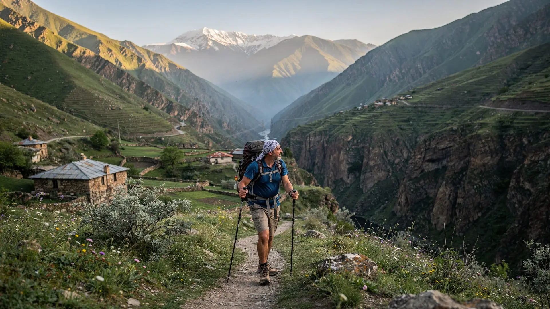
The northern sections of the Armenian TCT, running from the Georgian border through Tavush province and into Lori, are among the best-developed and most consistently marked parts of the entire route. The trail here passes through Dilijan National Park, following forest paths through old-growth beech and oak — some of the oldest forest stands in the South Caucasus — past Lake Parz and the medieval academy of Goshavank, and then climbing into the higher terrain of Lori toward Haghpat and the town of Stepanavan.
This section is consistently described as one of the most beautiful on the entire Armenian route, not just the most marked: the combination of forest hiking, meaningful historical sites, manageable elevation changes, and good wild camping sites makes it ideal for first-time multi-day hikers in the region. Village guesthouses appear roughly every two days on the northern route, and some of these — particularly around Dilijan and in the valleys of Lori — are making real efforts to cater to through-hikers with early breakfasts, drying rooms, and basic resupply options.
Distance from the Georgian border crossing area to Vanadzor: approximately 160 kilometres, typically covered in 8-11 days depending on pace and side trips to monastery sites. If you have the time to extend into Haghpat and Sanahin — both UNESCO World Heritage monasteries in northern Lori — do so: they are among the finest examples of medieval Armenian architecture and the detour adds one day at most.
The central highland: Aragatsotn and Kotayk
The section crossing Aragatsotn province includes some of the most dramatic and challenging terrain in Armenia: the slopes of Mount Aragats — at 4,090 metres, the country’s highest point — the alpine landscapes around Lake Kari at 3,185 metres, and the descent through the Kasakh gorge toward the medieval monasteries of Hovhannavank and Saghmosavank.
This is genuinely high-altitude hiking, and several sections go above 3,000 metres in the Aragats traverse. The weather above 2,500 metres changes quickly in the Caucasus summer: mornings can be clear and warm, afternoons bring building clouds and occasional thunderstorms. The marking in the Aragatsotn section is complete as of 2025 but the terrain demands more mountain experience than the Tavush forest section. Trekking poles, a reliable tent, and a sleeping bag rated to at least -5°C are not optional here.
Snow can persist in the Aragats plateau approaches into late June and occasionally July. Check current conditions through the TCT app or the volunteer trail community (the TCT Facebook groups are surprisingly active and useful for current condition reports) before committing to the high route.
The reward for getting this section right is substantial: the views from the Aragats approaches — across the entirety of the Armenian plateau to Lake Sevan in the distance, west to the Turkish border and the cone of Greater Ararat on clear mornings — are among the best panoramic hiking views in the Caucasus.
Guided day hike on the slopes of Mount Aragats from YerevanThe south: Vayots Dzor and Syunik
The southern sections of the TCT, covering Vayots Dzor and Syunik province, are the most recently developed and the most variable in marking quality. Large portions of the Syunik route have been blazed and documented, including the section through the Vorotan gorge country near Tatev, the high ridges above Goris, and the approaches to Kapan.
However: the southern TCT in Syunik passes through territory where the security situation requires genuine attention. As of June 2025, TCT Armenia’s official guidance recommends checking current conditions before hiking sections of the southern route that approach the line of contact in eastern Syunik. This is not a reason to avoid Syunik hiking in its entirety — the vast majority of the hikeable route is safely distant from any sensitive areas — but the southernmost sections, particularly between Kapan and the areas approaching the Meghri corridor, should not be hiked without current local knowledge and ideally a local guide.
The Vayots Dzor section, passing through wine country around Areni and the Noravank canyon, is fully safe and spectacularly beautiful. The combination of high-altitude hiking and walking through one of the world’s oldest continuous winemaking regions — past vineyards where Areni Noir grapes grow on volcanic terraces — is unlike anything else on the Armenian route.
The Janapar Trail, the separate long-distance route that historically ran through what was Nagorno-Karabakh, is not currently open for tourism and should not be planned for.
Planning a section hike
For visitors who want to hike a meaningful section of the TCT in Armenia without committing to the full route, three options stand out consistently in their combination of accessibility, marking reliability, and scenery:
The Dilijan loop (4-6 days): The Tavush section in and around Dilijan National Park is the most accessible starting point. Begin from Dilijan town itself, loop through Lake Parz and Goshavank, camp in the national park on nights two and three, and return via a different forest route. No technical difficulty, reliable markings, and guesthouses available in Dilijan at both ends. This is the TCT section I recommend most unreservedly to hikers who want their first Caucasus multi-day experience.
The Aragats traverse (2-4 days): A more demanding option, traversing the slopes of Aragats from the Alphabet Monument approach up to Lake Kari and across the northern plateau. This requires camping gear, experience with high-altitude hiking, and careful attention to weather forecasts. The views justify the additional commitment. Best attempted July through early September.
The Tatev-Goris section (3-5 days): The most dramatic southern option, through gorge country and high Syunik terrain that includes the Vorotan River canyon. Currently hikeable with current guidance; I would recommend doing this section with a local guide based in Goris who can advise on current conditions and knows the area.
Gear, navigation, and resupply
The standard long-trail hiking kit applies with a few Caucasus-specific additions. Three-season sleeping bag (temperatures at elevation can drop to near freezing even in July nights), waterproof jacket essential (afternoon storms are frequent above 2,000 metres), trekking poles very useful for the rocky scree sections in Aragatsotn and Syunik, and solid ankle-support boots rather than trail runners for the high sections.
Water: reliable in Tavush and northern Lori, less predictable in the Aragatsotn high section and some of the drier southern terrain. Carry at least 2.5 litres capacity and treat water from sources above habitation, particularly on the Aragats plateau where grazing animals use the same water sources.
Navigation: the TCT app (iOS and Android, free, with offline capability) is the primary navigation tool. The blazed trail markers are reliable in the well-developed sections but gaps exist, particularly in Vayots Dzor and parts of Syunik, and the app is essential for course correction. Download all relevant offline tiles before heading into areas with no mobile signal.
Resupply is more feasible than the word “wilderness” suggests: the TCT in Armenia is not a remote route in the way the Pacific Crest Trail or the Continental Divide Trail are. Villages appear every two to three days on most sections, and basic resupply — bread, canned goods, fresh produce in season, bottled water — is generally available. Dilijan, Gyumri, Vanadzor, and Goris have proper supermarkets for more substantial resupply stops.
The volunteer culture
One of the things that distinguishes the Transcaucasian Trail from comparable long-distance trail projects elsewhere is the strength of its volunteer culture. The trail has been built almost entirely by volunteer teams — often international groups of outdoor enthusiasts who spend a week or two each summer doing trail clearing, blaze painting, signpost installation, and erosion repair. The coordination is done by a small professional team based in Tbilisi, but the labour is volunteer.
This has two practical consequences for hikers. First, the trail quality reflects the volunteer effort, which means it is generally excellent where teams have been active recently and can be patchy where they haven’t. Second, the community around the trail is genuinely welcoming to people who want to contribute: if you have a week in Armenia and want to spend it doing something useful while seeing spectacular terrain, contacting TCT Armenia about volunteer opportunities is a realistic option. The volunteer weeks typically happen in June and September and involve teams of 10-20 people working on specific sections. No special skills required beyond fitness and willingness to be outside all day.
The social media presence of the TCT volunteer community is also a useful resource for current trail conditions: the Instagram accounts and Facebook groups used by hikers and volunteers post real-time updates on snow coverage, flooding, bridge damage, and rerouting that official sources don’t always capture in time.
What comes next for the TCT
The trail-building teams are working on three priority sections for 2025-2026: a more direct and clearly marked route through the transition zone between Lori and Aragatsotn, better marking and infrastructure in the Vayots Dzor middle section, and — contingent on the security situation — eventual completion of the Syunik route to the Iranian border.
The TCT Armenia volunteer community is active and welcoming to people who want to contribute to trail maintenance during their trip. Several multi-day volunteer trail-building weeks are organised each summer; check the TCT website for dates.
The complete TCT Armenia hiking guide has the full logistics breakdown including transport access points and resupply details for each section. The Dilijan hiking guide and the Aragats summit guide cover the most popular sub-sections in detail.